Distribution for Italy
3DGEOIMAGING is authorized distributor for Italy of GPR-SLICE software,
the most complete Ground Penetrating Radar imaging solution for processing, displaying, and interpreting ground-penetrating radar data.
GPR-SLICE v7.0 (c) (1994-2018) is a complete imaging and signal processing software compatible with all the major manufacturers of radar (Mala Geoscience, Sensors and Software, IDS, US Radar, Ditch Witch, ERA Technology, 3D Radar of Norway,UTSI Electronics, Geoscanners, Leica, Proceq, Zond Radar, Koden Radar, GeoTech, Transient Technologies, Loza, SEGY and SEG 2, plus customized format for research radar system) and is compatible with single channel and multi-channel equipment.
Software training
On-line basic and advanced software training are provided on a wide variety of subjects, including time slices and GPR volume creation, vector imaging for tunnel inspection and wall scanning, horizons detection and mapping, underground utilities mapping.
If you want to become quickly familiar with the software, customized daily and weekly on-line and on-site training are offered !
Software features
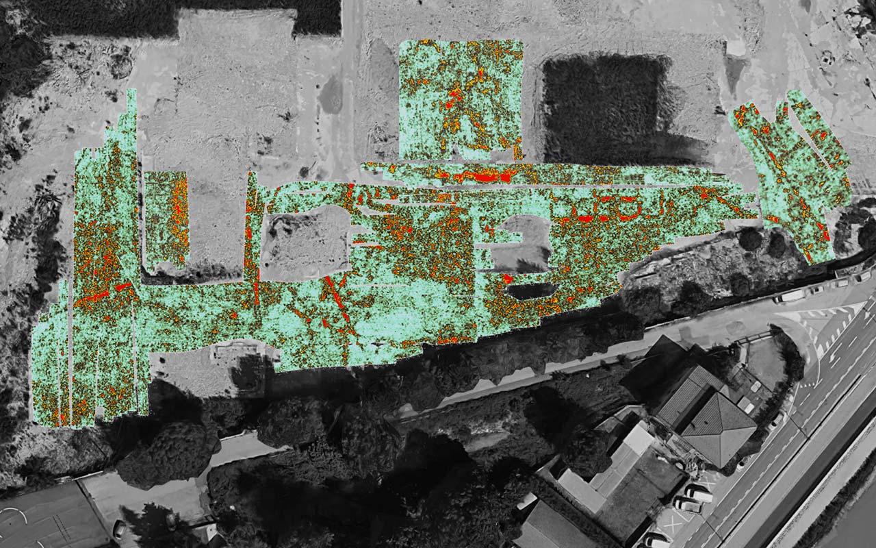
– 2D/3D time slices creation
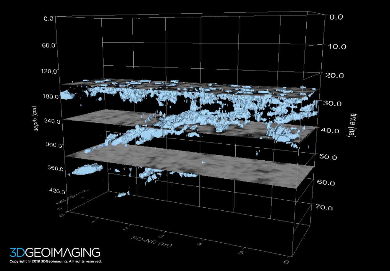
– 3D volume computing and displays, Isosurface Rendering, Fence Plots
– Antenna yaw, pitch and roll used in projecting scans
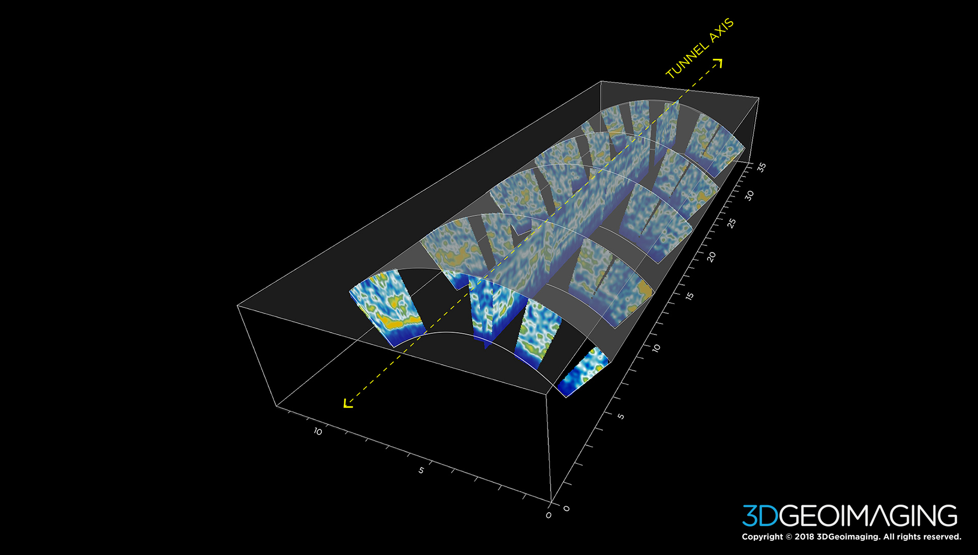
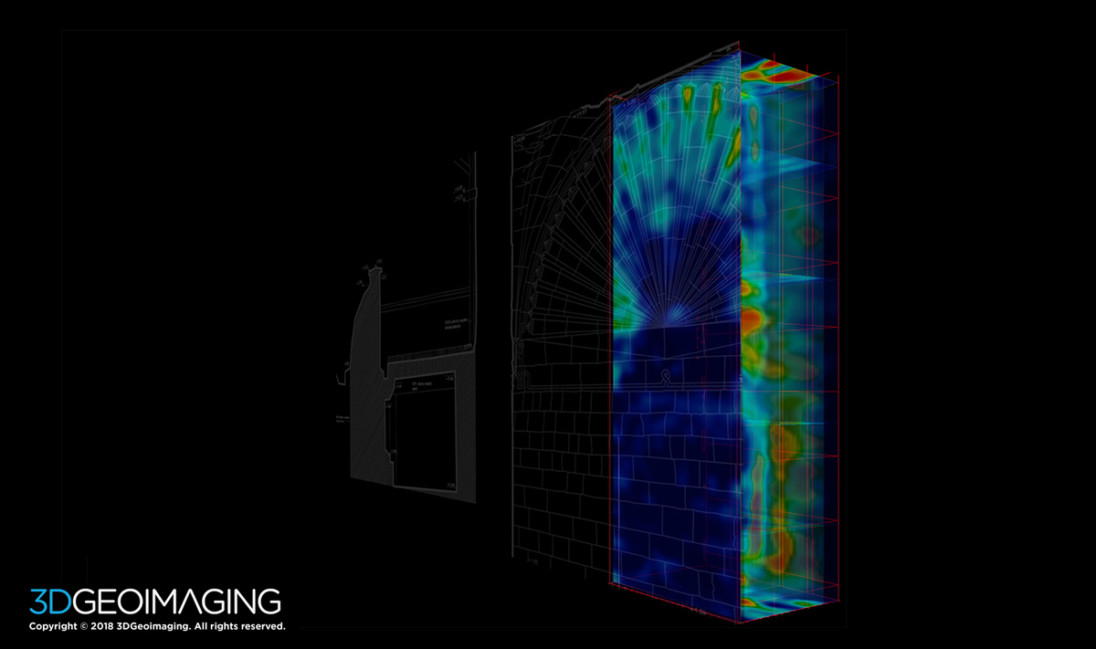
– Longitudinal tunnel radar survey menu for automatic vector setting
– Radial tunnel survey menu for automatic vector setting
– Meandering track menu and automatic vector
– GPS 2D/3D Time Slices
– GPS 2D/3D Radargram Displays
– Specialized menu for editting/filtering GPS fallout
– Batch GPS topography corrections
– Builtin UTM utility conversion
– Exportability to GIS (world file creation)
– Direct export to Google Earth (*.kmz image file creation)
– Builtin GPS staggering/scan lag latency correction
– Complete GPS integration
– FK Radargram filtering
– Migration with variable velocity profiles
– 3D/2.5D migration
– Bandpass filtering and spectra menu
– Spectral whitening
– Deconvolution
– Hilbert Transform
– Boxcar smoothing
– Background removal
– Regain
– Radargram differencing
– Fast Fourier Transform – 2D spatial frequency time slice filtering menu
– Image Processing
– Mosaic correction menu
– 2D FFT grid filtering
– Overlay analysis
– Grid math
– Individualized map transform controls
– jpeg / bmp / dxf / kmz / jgw / bmw / png / pdf outputs
– 2D surface displays and automatic animation creation
– Open GL 3D real time flythroughs, x, y, z, xy fence diagrams, isosurface rendering
– Open GL 3D radargram displays
– Automatic animation creation
– Open GL Object drawing for interpretation (pipes, rectangular volumes, spheres etc )
– DXF file creatio
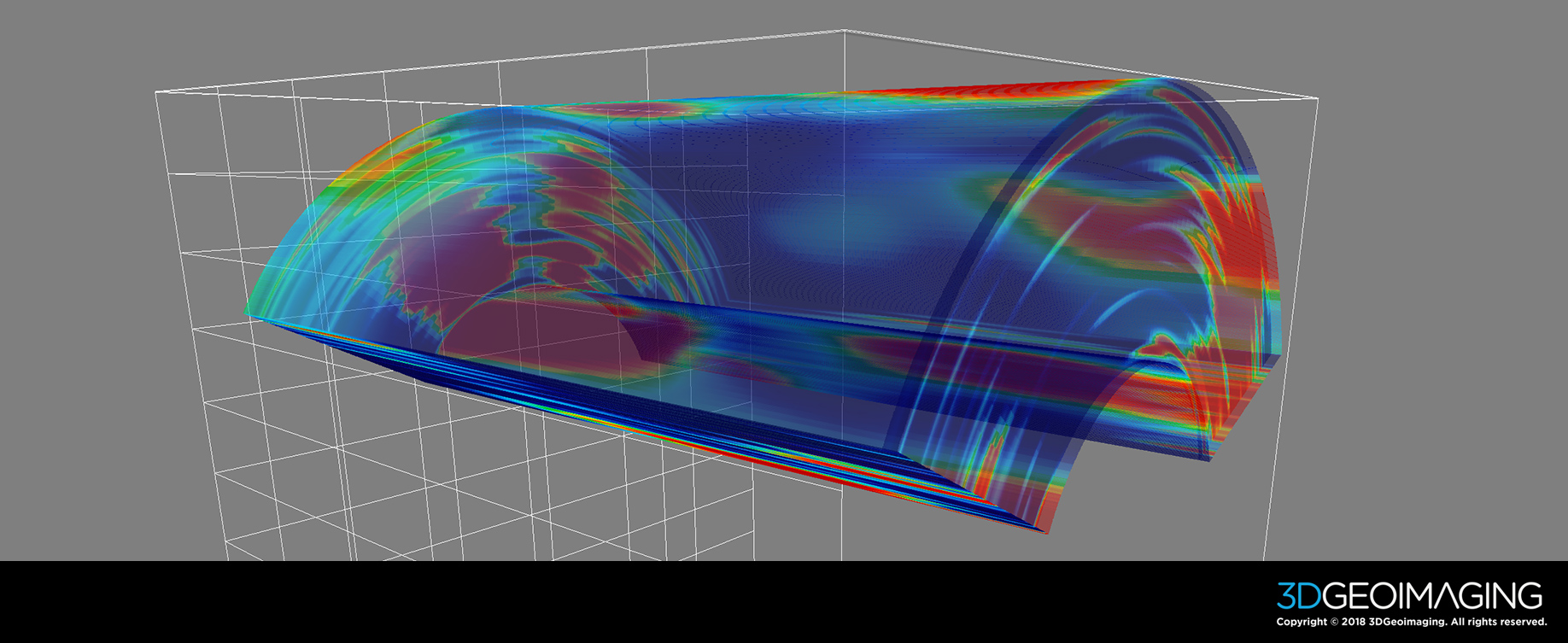
– Cylinder volume warping for imaging tunnels
– Exportable animation menu
– Multi-threaded animation displays
– Unique processes including Overlay Analysis
– Static corrections for topography
– Static corrections accounting for antenna tilt
– Zero(ns) scan-by-scan or Zero(ns) line-by-line offset auto detection/editing of radargrams menu
– Automatic horizon detection
– Layer depth maps using variable layer velocities
– Horizon amplitude profiles and maps
– Horizon slicing in Open GL 3D Volume
– Batch processing
– Customizable multi-time slice and radargram displays
– Easy grid connection and appending
– Specialized filters to automatically remove mosaic noises from multi-grid surveys
– Time slice differencing for GPR monitoring – 4D surveys
– Radargram differencing for GPR monitoring – 4D surveys
– Volume differencing for GPR monitoring – 4D survyes
– Importability and processing Magnetometer, Resistivity, EM data aadar systems
– Radargram tunnel/cylinder warping
Refer to the GPR-SLICE web-site and Facebook group to go deeper in the software.
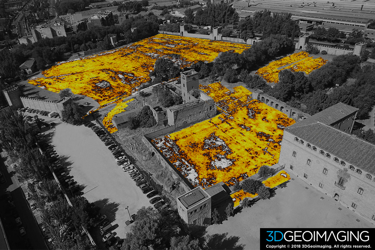
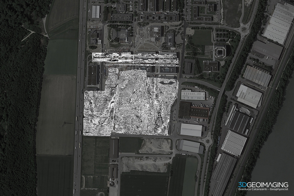
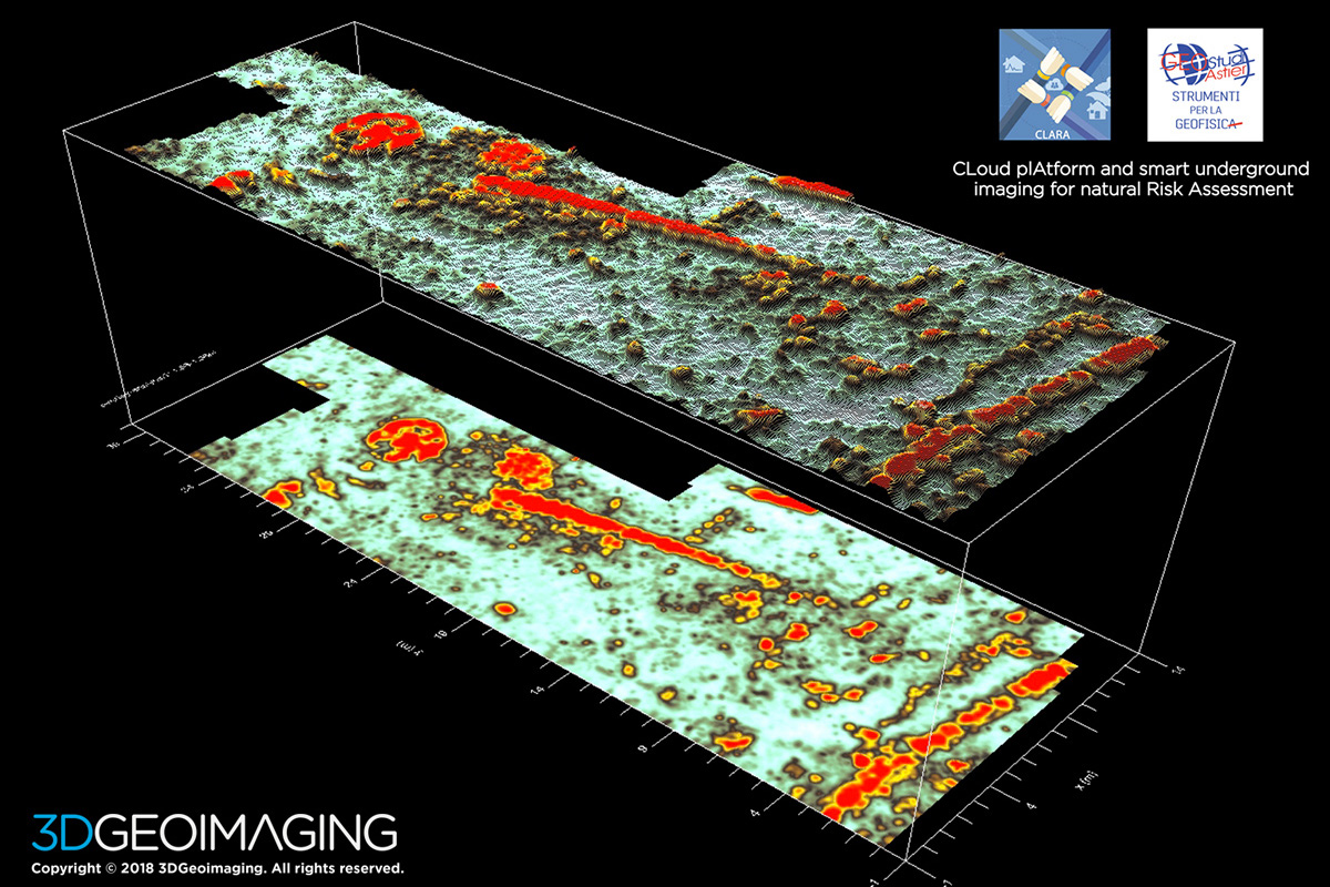
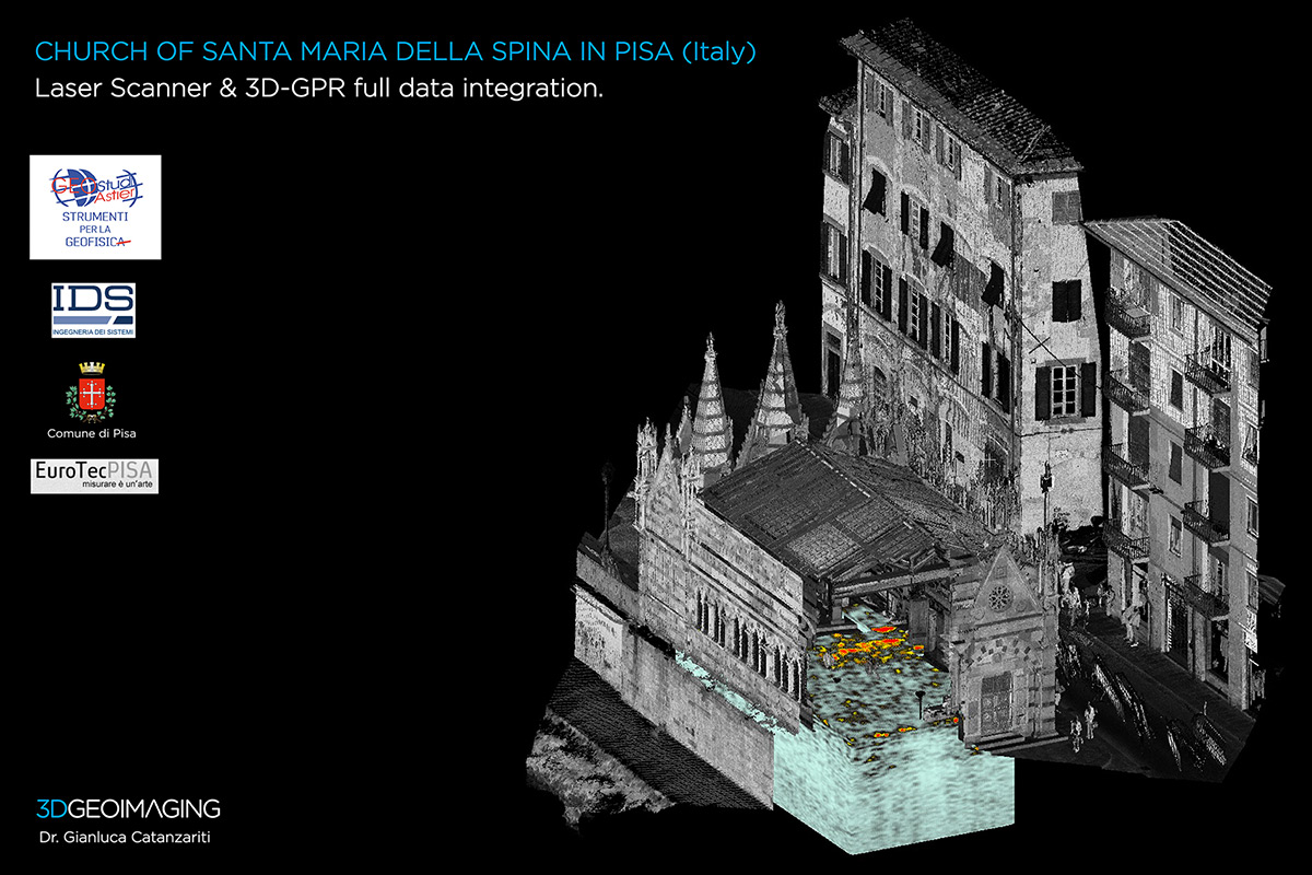
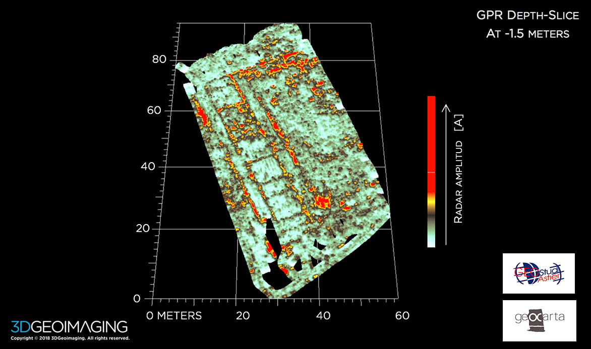
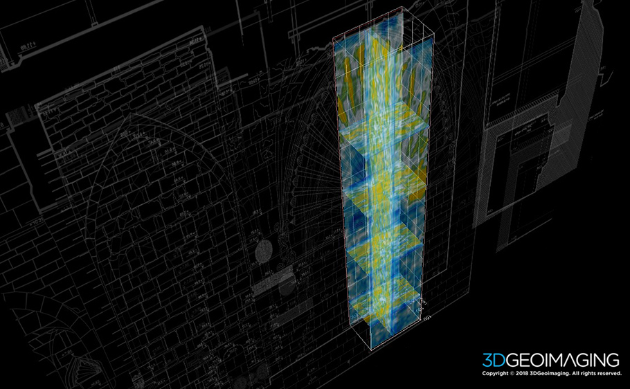
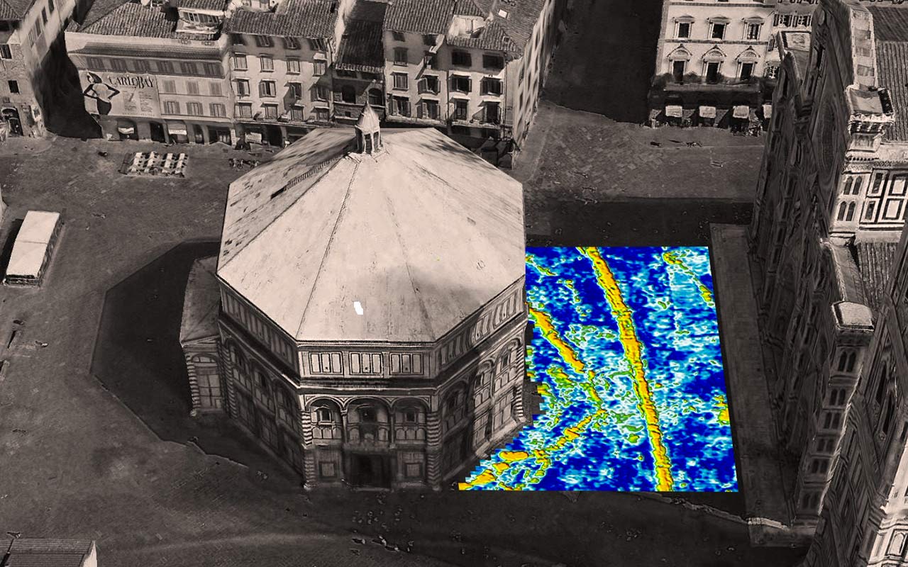
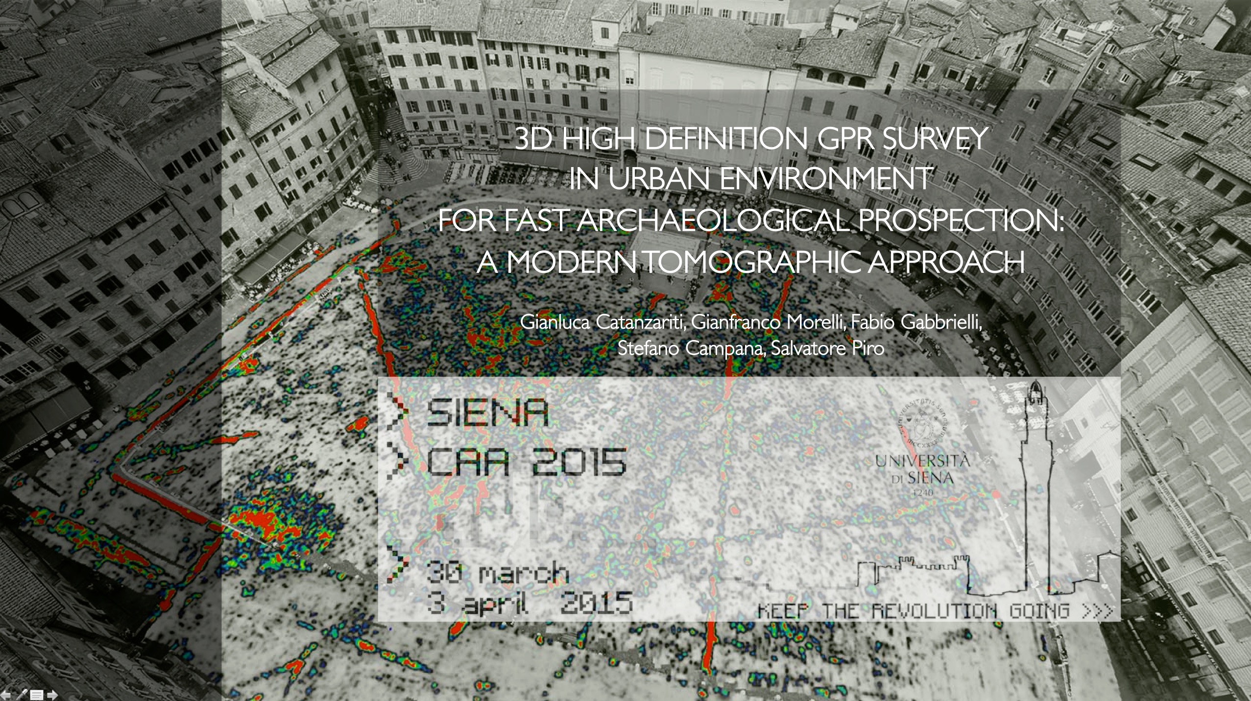
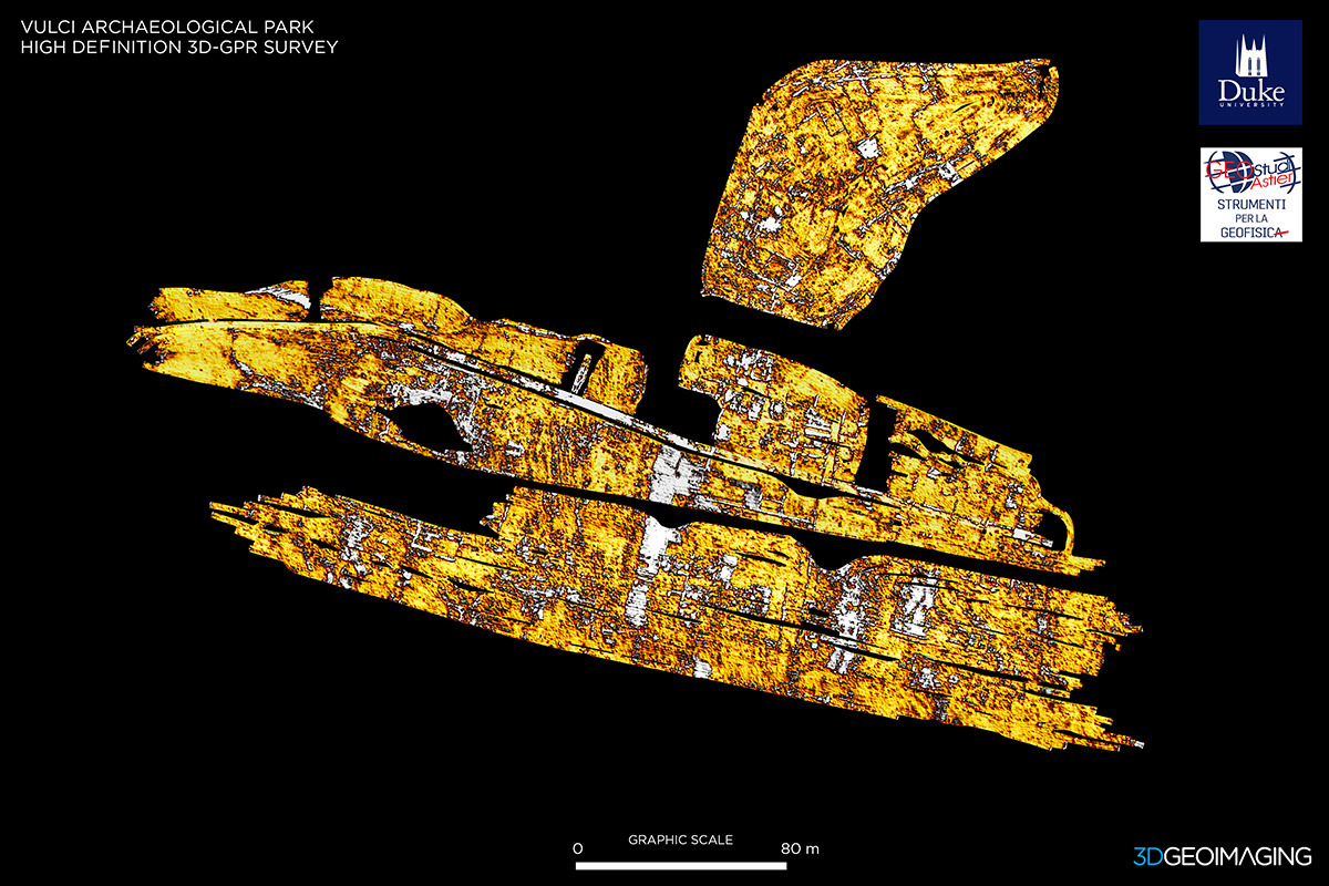
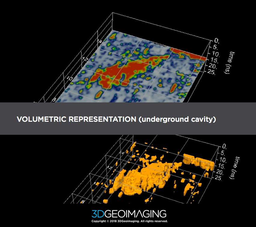
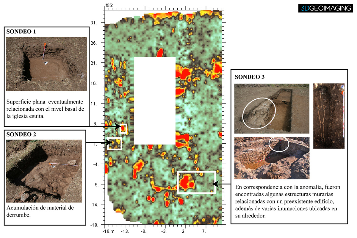
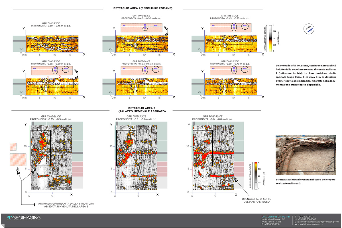
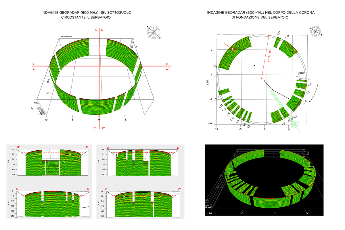
GPR Imaging Gallery